Research areas
Interactions between climate change and geomorphology
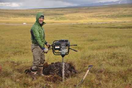
Geomorphologic process interact with processes of climate change. We study these interactions in the Arctic, where frozen soils contain vast amounts of organic carbon that can influence the global carbon cycle and affect climate change. We explore the influence of erosion and deposition by hillslope and riverine processes on the carbon cycle in Arctic areas using field work, landscape evolution models, topographic analysis, remote sensing, and image analysis techniques.
The image to the left show drilling into frozen, carbon rich soils in Alaska.
Modeling landscape evolution
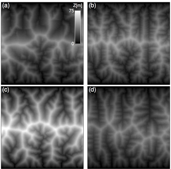
Lithologic, tectonic, and climatic factors influence the processes that shape the landscape. However, these processes typically occur over periods that are much longer than a human's life-time and hence it is difficult to quantify the influence of these factors directly from field observations. To investigate the influence of these factors on the landscape's form, we use analytical and numerical models that simulate landscape response to different factors. Our research focuses on development of such models and on using them to explore processes of landscape evolution that can explain the patterns we see in nature.
The image to the right shows topographic maps of landscapes produced by a landscape evolution model with different techniques (i.e., panels a-d) for routing water flow across the landscape. Lighter colors mark higher elevation.
The structure of river networks
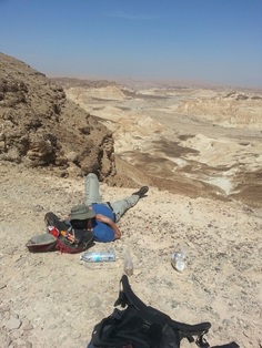
Channel networks are observed on land, on the ocean floor, and on other planets. On earth, they are the primary mean for transporting water and sediments, and play a major role in determining the distribution of elevation, water and life. We use field observations, topographic, bathymetric, and in some cases even seismic data, together with landscape evolution models to detect patterns in the structure of these networks and study how it relates to the physical conditions and processes under which they are formed.
The image to the left shows (extended) lunch break overlooking an area of major channel networks reorganization in the Negev Desert, Israel.
Geomorphology and tectonics
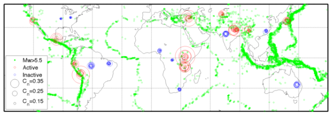
Tectonic processes form major topographic features and interact with the geomorphologic processes that shape these features. We explore these interactions by studying the topography and structure of tectonically active regions using field work and topographic analysis combined with numerical models.
The image above shows a metric of geomorphologic asymmetry (Cn, blue and red circles, larger circle marks higher asymmetry) laid over a global map of seismic events (green dots), note that seismically active areas are associated with high degree of geomorphologic asymmetry.
